Argomenti trattati
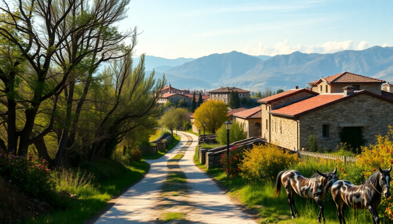
The Via degli Abati offers a unique glimpse into Italy’s rich history, intertwined with breathtaking landscapes and charming villages. This historical path stretches approximately 190 kilometers from Pavia to Pontremoli, taking adventurous travelers through the northern Apennines. Ideal for those who seek an authentic experience far from the crowded tourist routes, this trek combines elements of spirituality, nature, and the joy of walking through serene, untouched regions.
A journey steeped in history
Rooted in the legacy of Saint Columbanus, an Irish monk who founded the Abbey of Bobbio in the 7th century, the Via degli Abati served as an essential route for monks traveling to Rome for religious and political purposes. During the Lombard period, this mountainous trail became one of the safest passages between Northern and Central Italy, enjoying the patronage of Lombard kings who supported Columbanian monks.
Unlike the more commonly known Via Francigena, which traversed the unstable plains of the Duchy of Tuscia, the Via degli Abati meanders through the mountains, connecting isolated valleys, forests, and ancient villages. For centuries, it has welcomed pilgrims, clerics, and travelers who sought hospitality in monasteries along the way. However, as the influence of monastic life waned and more accessible routes emerged, this historical path faded into relative obscurity until it was rediscovered by enthusiasts and historical walking organizations.
The route unfolds
The Via degli Abati is segmented into eight main stages, each showcasing its own environmental and technical characteristics. Starting from the historic city of Pavia, the trek leads into the stunning Emilia-Romagna and Tuscany regions, filled with lush woodlands, dirt roads, and breathtaking mountain vistas.
Beginning in Pavia, walkers are greeted by medieval towers and the illustrious University. The path soon transitions into the verdant Ticino Park, where hikers meander through agricultural fields and cross the remarkable Becca Bridge over the Po River. After crossing the river, the trail enters the picturesque Oltrepò Pavese region, characterized by rolling hills dotted with farms and vineyards. The ascent to Colombarone, a quaint rural settlement at an altitude of 236 meters, marks the completion of the first stage—a short yet steep climb through a scenic landscape.
Challenges and rewards
The second stage of the trek presents a more demanding challenge as hikers descend towards Caminata and the Tidone River, followed by a lengthy ascent through forest trails and dirt roads. This stage leads to the Alpino Garden of Pietra Corva, known for its rare botanical species, and culminates with a descent into the medieval town of Bobbio, the spiritual heart of the journey.
From Bobbio, the trek continues up the Trebbia Valley towards Coli, eventually reaching the Sella dei Generali—an important watershed between the Trebbia and Nure Valleys. The surrounding environment is breathtaking, with vast mountain landscapes filled with meadows and woodlands. After a night spent at higher altitudes, the path descends into the Val Nure, passing through charming hilltop villages connected by serene trails.
Scenic highlights
As trekkers leave Groppallo, they encounter one of the most picturesque sections of the route. The ascent from Groppallo to Bruzzi leads to the Passo di Linguadà, offering panoramic views. Alternatively, a more demanding variant climbs to Monte Lama, rewarding hikers with stunning vistas. The descent towards Bardi, dominated by its impressive medieval castle, is equally captivating.
Subsequently, the longest and most arduous stage of the Via degli Abati awaits. Departing from Bardi and descending to Ponte Ceno, hikers traverse rugged terrain through small villages like Monastero, Brè, and Pieve di Gravago, before facing the final ascent towards the Taro Valley, culminating in the vibrant town of Borgo Val di Taro (Borgotaro), equipped with ample services.
The final stretch
The last leg of the journey presents a spectacular finale. Departing Borgotaro, trekkers cross a bridge over the Taro River, climbing through S. Vincenzo and Valdena to the scenic Passo del Borgallo, marked by a commemorative stone at the Emilia-Romagna and Tuscany border. From here, the descent leads through enchanting landscapes featuring waterfalls and dense forests, ultimately guiding travelers to the elegant historic center of Pontremoli, the official endpoint of the Via degli Abati.
Preparing for the adventure
While the Via degli Abati can also be traversed by bicycle, it is essential to note that the trail is not primarily designed for cycling. Many sections are steep and rugged, best suited for mountain or gravel bikes and well-prepared riders. Some parts may require cyclists to push their bikes due to challenging terrain.
The best time to embark on this journey is from May to October, avoiding the colder months when mountain paths may be snow-covered or impassable. In the summer, early morning starts are recommended, especially for longer and sun-exposed stages. With careful planning and reliable GPS tracks, trekkers can navigate this less-traveled path, ensuring a fulfilling experience among Italy’s hidden treasures.
Accommodation options
Throughout the Via degli Abati, basic accommodations are available, aligning with the journey’s authentic spirit. Options include family-run B&Bs, private homes, and parish hostels. Planning is crucial, as many establishments have limited availability, particularly in smaller villages. In larger towns like Bobbio, Bardi, and Borgotaro, more comprehensive lodging options exist, including hotels. In more remote areas, such as Colombarone or Groppallo, accommodations may be simpler yet warm and welcoming, offering a true taste of local hospitality.
Travel logistics
The most common starting point for the Via degli Abati is Pavia, easily accessible by train from Milan (30-40 minutes) and other Northern Italian cities. The train station is conveniently located just a short walk from the city center, where the trek officially begins. The journey culminates in Pontremoli, well-connected by the Parma–La Spezia train line, allowing for easy travel back or onward journeys. Public transport options are available at various points along the route, although it’s wise to check schedules in advance, especially in the more remote Apennine areas, where services can be limited.

